There are various hiking trails to be found around the Vatnajökull Region and many of them can be found within Vatnajökull National Park. These hiking trails are marked according to a trail difficulty factor that can be viewed here. By marking the trails by the difficulty it is guaranteed that everyone should be able to find a hiking trail that fits their preference. Taking a walk through the unique natural beauty in Vatnajökull Region is an activity for everyone to enjoy.
Breiðármörk
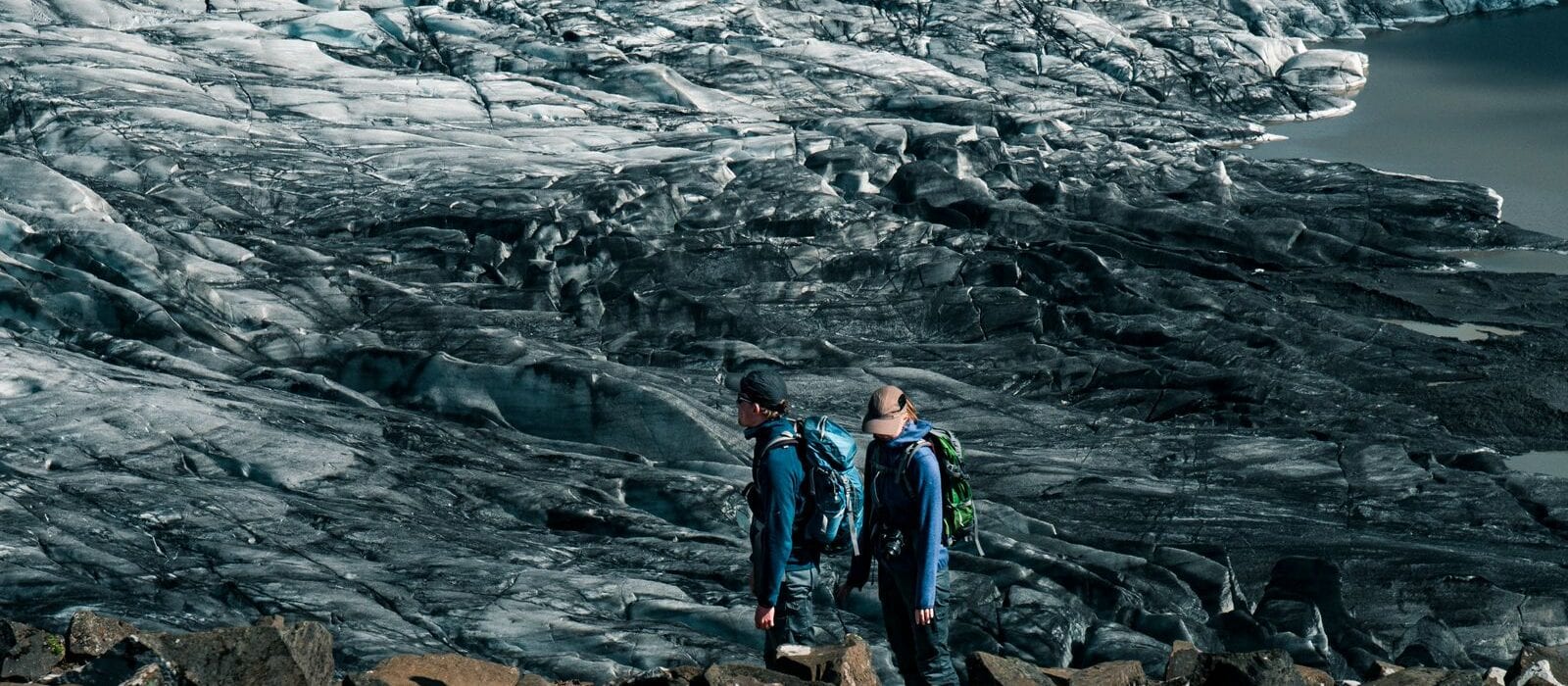
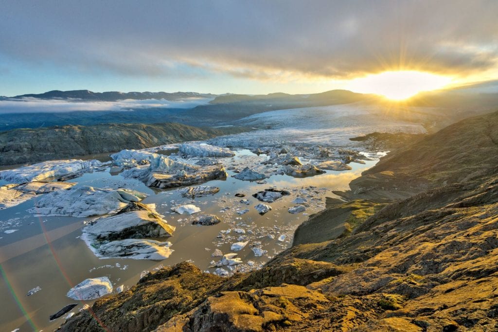
This map shows the trail between Jökulsárlón and Fjallsárlón at Breiðamerkursandur. The path at Breiðármörk is a part of a larger system of hiking trails which is being built in Austur-Skaftafellssýslu and will connect everything from Skaftafell in the west to Lónsöræfi in the east. The hiking trail is approximately 15 km long and lies past three glacial lagoons. On the way, there will be information into the vegetation, birdlife, and geology of the area as well as information concerning how life was in the olden times on this isolated land which through the years has been affected by the glaciers and the current heavy glacial rivers.
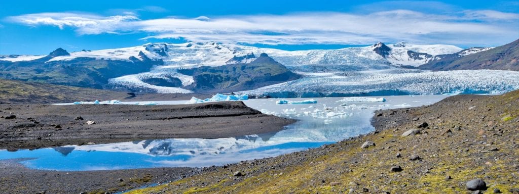
Fjallsárlón – Þorvarður Árnason
Although Breiðármörk is classified as a red path most of it is blue. The path lies across sands, moraines, and varied terrain. The land is not all flat yet there are not any substantial changes in height, neither are there any unbridged lakes so it offers a nice route for hikers. The path is around 15 km long and it is estimated that it takes around 5 hours to walk it. There is no drinking water to be found along the way so it is necessary to be well prepared.
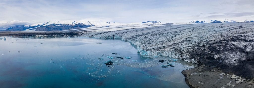
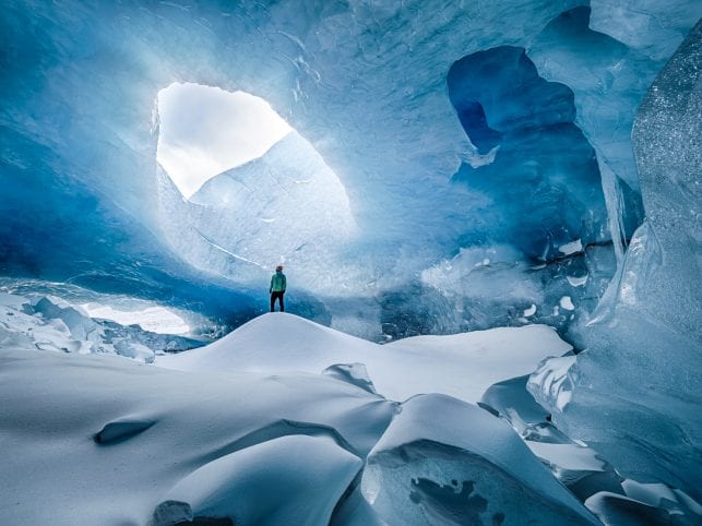
Breiðamerkurjökull – Páll Jökull Pétursson
Heinaberg, Hjallanes, Hoffell
Three large glacial tongues are in the area of Heinaberg and Hjallanes, which consists of Hjallanes west of Kolgríma and Heinaberg in the east. It is rare to find glaciers in such proximity to an entire community. It is normal to see herds of reindeer in the area from autumn to spring. During the little ice age and until the 1900 century, the glacial tongues of Skálafellsjökul and Heinabergsjökull connected in front of Hafrafell. In that time a glacier lay on Hjallanes and there are varied markings to be seen in the area such as walls, erratics, and glacial grooves.
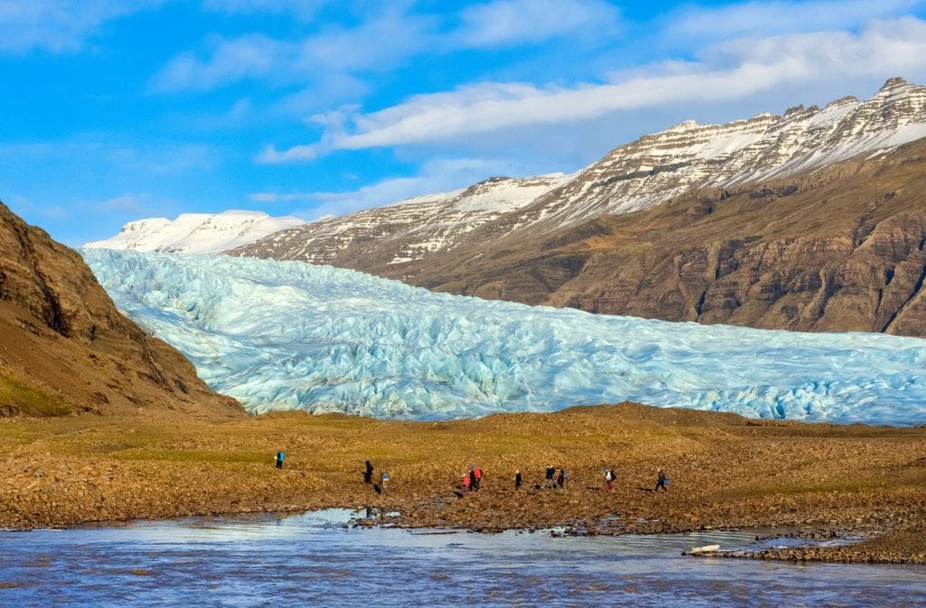
Fláajökull – Þorvarður Árnason
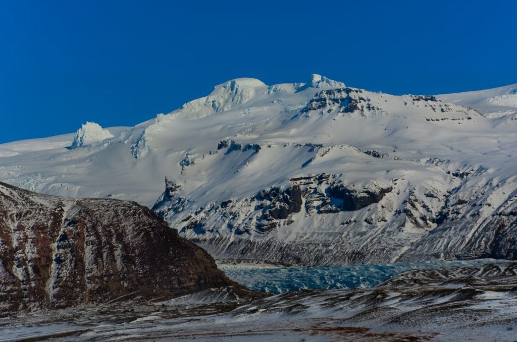
Hoffellsjökull is among the largest glaciers that fall south out of Vatnajökull. It has dug itself deep into glacial sand, up to 300 meters below sea level, but due to the fast-shifting of the glacier, a glacial lagoon is forming. Hoffellsjökull crawls through an old volcano which is associated with Geitafell and was active around 5-6 million years ago. Due to the rising and splitting of the land, it is possible to see rock-forming deep in the crust of the earth, for example in Geitafellsbjarg east of the glacier there are magma intrusions made mostly out of gabbro.
Here you can see the varied paths around this magnificent area molted out of glaciers and old volcanoes.
Hoffellsjökull/Geitafell – Þorvarður Árnason
Skaftafell and the surrounding area.
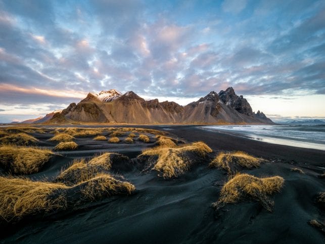
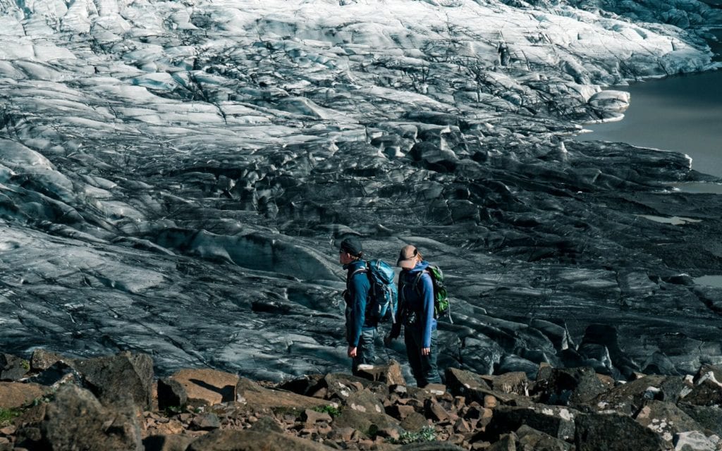
The area around Skaftafell is characterized by contrasts. Glaciers are in the area and over them rise tall mountains where Hvannadalshnjúkur in Öræfajökull rises the highest. The land shows signs of erosion due to glaciers and glacial lagoons. The glaciers have moved forward quite a bit and expanded the most around 1890, but have since been receding in recent years.
Öræfajökull/Skaftafell – Þorvarður Árnason
Glacial lagoons have spread over the land and brought forward the elements that makeup Skeiðarársand. The lagoons were large movement barriers but when the bridge was built across Skeiðarár in 1974 and the ring road around Iceland opened. Since 2009 Skeiðará has flowed to the west in front of the glacial terminus of Skeiðarárjökull. There it combined with Gígjukvísl and flowed to the sea.
Skaftafellsjökull – Þorsteinn Roy Jóhannsson
Around Skaftafell there is a lot of volcanic activity. In the year 1362, Öræfajökull erupted and it was the largest eruption that has happened in Iceland since records have been kept. Öræfajökull erupted again in 1727 but that was quite smaller in comparison. Grímsvötn is the most active volcano and in 2011 erupted with lots of ash spewing around. Grímsvötn is also known for the glacial bursts which have their source there.
See more hiking trails around this magnificent area here.